
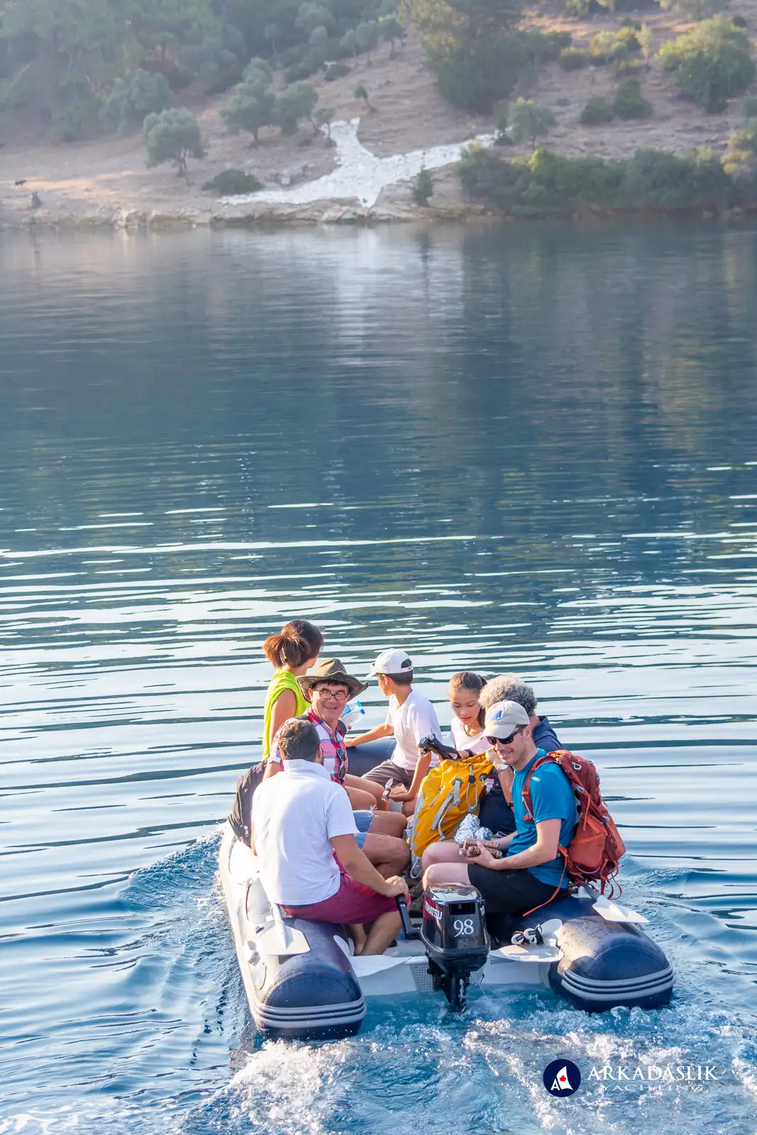
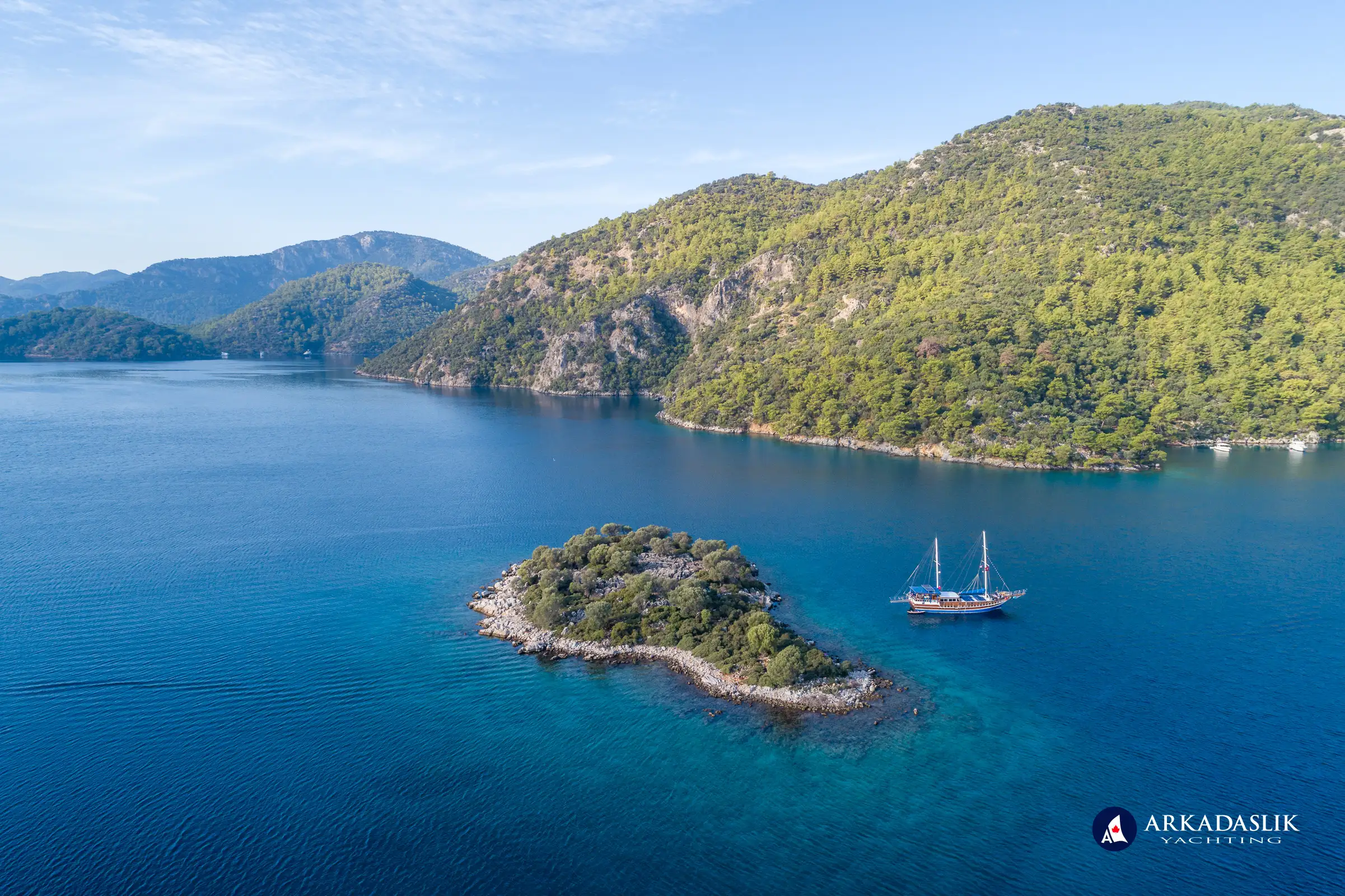
Located on Turkey's Mediterranean coastline, the Göcek Islands form a serene archipelago that charms boaters, nature lovers, and those seeking both tranquility and a touch of adventure. A short sail from Fethiye, these islands offer sheltered waters, scenic beauty, and fascinating historical remnants, making them a popular cruising destination. While the area has grown in popularity over the years, the Göcek Islands still provide opportunities to swim in quiet bays, unwind on uncrowded beaches, and explore the natural and cultural highlights of the region.
The area remains largely undeveloped due to its status as an area of special protection since 1988, ensuring that its natural beauty remains preserved for generations to come. With several unique islands and bays, each offering its own charm and attractions, this region is a dream for those seeking a luxurious yet tranquil escape.
Individual Islands and Bays in the Göcek Islands
Göcek Town
While not an island itself, the town of Göcek serves as the gateway to the Göcek Islands. A bustling hub for yachting, this charming town offers everything from upscale restaurants and boutique shops to essential services like provisioning and boat repairs. Despite its modern amenities, the town retains a quaint charm, with picturesque streets lined with boutiques, cafes, and beautiful harbors. Visitors can spot luxurious superyachts, celebrities enjoying Turkish ice cream, and enjoy leisurely strolls through this peaceful coastal haven.
Aquarium Bay (Akvaryum Koyu)
Located between Tersane and Domuz Islands, Aquarium Bay is a stunning bay known for its exceptional turquoise waters. It's named for the ancient lighthouse foundation submerged beneath the crystal-clear water. Early mornings and late afternoons are the best times to visit, as this bay can get crowded with day boats during peak hours.
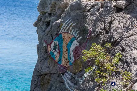
Bedri Rahmi Bay (Taşyaka Koyu)
Bedri Rahmi Bay is named after the famous Turkish poet and artist Bedri Rahmi Eyüboğlu, who painted a stylized fish on the rocks here. This bay is not only known for its natural beauty but also its historical significance, with ruins of the ancient Carian town of Krya scattered among the trees. Anchoring here is a unique experience, with two waterfront restaurants and access to fresh spring water.
Boynuz Bay (Boynuz Bükü)
A narrow bay with a muddy bottom, Boynuz Bükü is a safe anchorage, especially during storms. Though small, it offers a quiet retreat, complete with a local restaurant where visitors can sample delicious Turkish dishes. Due to its small size, larger boats may have difficulty finding a spot to moor.
Devil Island (Şeytanlı Adası)
Devil Island derives its name from the dangerous rocks that lie just beneath the surface of its shore. The island's striking landscape has inspired local legends, with some suggesting that it was once the Devil's chosen domain. Although the island is not ideal for large vessels, it remains a popular destination for smaller yachts and adventurers looking to explore its mystical, wild coastline.
Flat Islands (Yassica Ada)
A collection of five flat, low-lying islands, the Flat Islands offer a unique landscape compared to other areas in the Göcek archipelago. They are particularly popular with day-trippers but provide a calm, tranquil environment for overnight stays, especially when the weather is mild. The islands are connected by sand spits, and the shallows make it an excellent spot for families with young children.
Göbün Bay (Göbun Koyu)
Known for its sheer rock walls and narrow entrance, Göbün Bay is perfect for sailors looking for a scenic stop. With a solar-powered restaurant, historic ruins, and hiking trails, this bay offers a unique blend of nature and culture. Larger boats may have difficulty navigating the narrow passage, but it remains a favorite for smaller yachts.
Göcek Island (Göcek Adası)
Göcek Island lies just off the town of Göcek, offering a restful escape just minutes from the harbor. The island’s tranquil beaches and lush pine trees make it an ideal location for relaxation. Accessible by a frequent water taxi shuttle service from the mainland, this is a favorite spot for those seeking respite while still being close to the amenities of Göcek.
Hamam Bay (Hamam Koyu)
Hamam Bay is famous for its ancient ruins, including a Roman bathhouse and a submerged Byzantine monastery. Despite the popularity of this bay with tourists, it remains one of the best places to experience both historical and natural beauty. For those seeking a thrill, there are ropes tied to overhanging trees for daring "Tarzan" swings into the crystal-clear waters below.
Kille Bay (Kille Bükü)
One of the quieter, lesser-visited bays in the region, Kille Bükü is a lovely spot for those who enjoy peace and solitude. The bay’s small pebbled beach is often used by locals for picnics and camping. The ancient church ruins high on the hill add an air of mystery to the area, and it’s a perfect location for a "first swim" during your cruise.
Merdivenli Bay (Merdivenli Koyu)
Named for the carved steps found in a cave at the canyon's entrance (merdivenli means "stairway" in Turkish), Merdivenli Bay offers a tranquil and scenic anchorage. Nearby, the small farming village of Merdivenli Köy enhances the area's charm with its traditional mosque and picturesque rural scenery. This bay is particularly popular with visitors who enjoy hiking and rock climbing, drawn to its rugged natural beauty and unique geological features.
Olive Island (Zeytin Adası)
Olive Island is privately owned and remains largely off-limits to visitors. Named after an Ottoman-era olive press discovered on its shores, the island can only be accessed by boat along certain sections of the coast. Despite its restricted access, its wild beauty and peaceful ambiance make it a unique stop for boaters passing by.
Pig Island (Domuz Adası)
Domuz Island, once home to wild boars (after which it is named), is now a privately owned island with limited anchorage. Visitors can marvel at its natural beauty and enjoy the surrounding waters, although opportunities for exploration are limited due to its private ownership.
Sarsala Bay (Sarsala Koyu)
One of the largest and most popular bays in the Göcek Islands region, Sarsala Koyu is especially favored by larger yachts. With its charming pebble beach, municipal facilities, and road access, it’s an ideal destination for visitors arriving from Dalaman airport or those seeking a relaxed day by the sea.
Seagull Bay (Martılı Koyu)
Known for its distinctive seagull mosaic and lovely hiking trails, Seagull Bay is an ideal spot for hikers and nature lovers. The bay is home to a small tea house and a stream that attracts goats and donkeys. While it can be windy, it remains a popular choice for a day trip to explore the surrounding ruins.
Tersane Island (Tersane Adası)
Tersane Island is rich in history, featuring ruins from the ancient Greek settlement of Telandria alongside the remains of an Ottoman shipyard. Popular with day-trippers, the island offers a peaceful retreat after hours. Boaters can explore the age-old ruins, enjoy hiking, or simply unwind in the serene waters of Summer Harbour Bay. One of our favorite features of the island – there are NO BEES! The abundance of wild thyme and wild tea naturally deters them.
The island was named after its Ottoman shipyard (the word tersane means "shipyard" in Turkish). The bay in front of the shipyard is small, so only sailboats and small gulets can access it. We highly recommend a visit for those who want to explore this historic site.
Explore the Göcek Islands Through Our Lens
Explore the breathtaking beauty of the Göcek Islands through our curated photo gallery, showcasing the stunning landscapes, enchanting waters, and historic charm of this Mediterranean paradise.
Click on any image to expand.


The Göcek Islands Region: A Must-Visit Destination for Yachting Enthusiasts
The Göcek Islands are a true sailing paradise, with each island and bay offering its own unique experience. From secluded beaches and tranquil anchorages to historic ruins and vibrant local culture, there’s something for every kind of traveler. If you’re planning a yachting trip in Turkey, the Göcek Islands should be at the top of your list.
Are you ready to explore the beauty of the Göcek Islands? Contact us today to plan your private yacht charter and discover the wonders of this stunning archipelago!